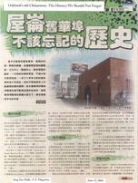
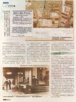
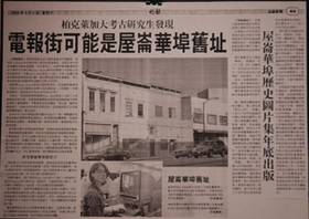
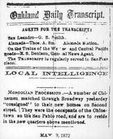
Articles from various local Chinese newspapers on the history of San Pablo Chinatown. Click on each image to view.
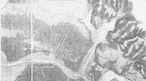
USGS Coastal Survey Map of 1857. Click on the image to view.
By the mid-1860’s, Edward Chew wrote, “the official ‘Chinatown'” in Oakland was north of town, on the east side of Telegraph between 16th and 17th streets.
Around 1867, a fire destroyed the Telegraph Chinatown. When city authorities prevented them from rebuilding, these early Oaklanders created a new Chinatown along the east side of San Pablo, in an area between today’s 19th and 20th streets. The surrounding land was mostly farmland with some residencies.
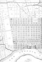
This 1859 Whitcher map shows almost all downtown development stopped south of 14th street. In the late 1960’s, after forcing the Telegraph Avenue Chinatown to relocate, city officials extended Broadway north of 14th street.
1859 Whitcher Map. Click on the image to view.
When the roads were to be built, the City Council ordered to have all unnamed property owners or tenants who were “in the way” to move, offering these tenants only $1 in compensation. (source: Oakland City Council Resolutions, Volume 1).
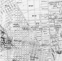
Official Map of Oakland, 1868. Click on the image to view.
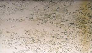
Artist interpretation of Oakland in 1870. Click on the image to view.
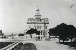
A photographer stood on Washington Street to take this picture of the new City Hall’s 14th street side. The area north of the City Hall was still largely rural.
Photo courtesy of Oakland Public Library, Oakland History Room. Click on the image to view.
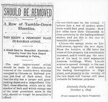
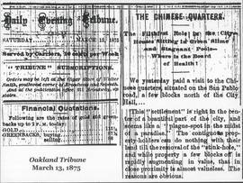
Many Chinatown residents resisted the move. Even three years after Chinatown residents were relocated, the Oakland Tribune had released an article claiming that the Chinatown must move in order to increase the value of the surrounding area. (Oakland Tribune, March 13, 1875).
Click on the image to view.
Click on the image to view.
It was common at the time for people trying to gain control of real estate in or nearby Chinatown to call it a “plague-spot” or “blight.” This also occurred in the cities of Alameda, Berkeley, San Francisco and San Jose.
Various articles described the Chinatowns as “plague-spots,” “diseased,” and “Black Spots.” Click on the images to view.
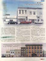
When city officials of the 1800’s displaced the residents of the San Pablo Avenue Chinatown, they were clearing space for redevelopment that included a fancy two-story Victorian across the street on the west side of San Pablo, a set of plain storefronts, and upstairs residencies on the east side.
Over 125 years later, these buildings still stand, bringing testimony and commemoration of the history of Oakland’s early Chinese pioneers.
Click on the image to view.
End of online exhibit.
This research was conducted by Anna Naruta, UC Berkeley Scholar in 2005.